
From the store, take a left and then a right (toward Bellingham Bay) on Harris Avenue for a block to 10th Street. Turn left and continue for two blocks. When the road goes left (.2 miles), run straight and pick up the trail as it heads to the left down the Padden Creek mini-gorge. This is the Interurban Trail and leads south for almost 7 miles to Larrabee State Park.
Continue heading east on wide trail past Fairhaven Park. When the trail comes to sidewalk at the corner of Julia and 18th, run left on sidewalk past the Rotary Trailhead, 0.9 miles, on your left. Just ahead, after crossing 20th Street, pick up the trail again at the brown and yellow trail posts.
After crossing another residential street, the wide gravel trail bends to the right and heads south. At 2.0 miles, run right at a fork and drop down before crossing Old Samish Highway. Once across, descend into a verdant canyon and run the mini roller coaster along Chuckanut Creek. In a couple hundred yards, cross the creek on a wood bridge and climb a short series of switchbacks. At 2.5 miles, reach the Lost Lake sign and a trail leading to the left. To continue south toward Larrabee State Park, go straight. For the Hemlock Trail/Raptor Ridge, Pine and Cedar Lakes, and Lost Lake, go left.
Larrabee State Park/Clayton Beach Parking Lot (13.8 miles out-and-back)
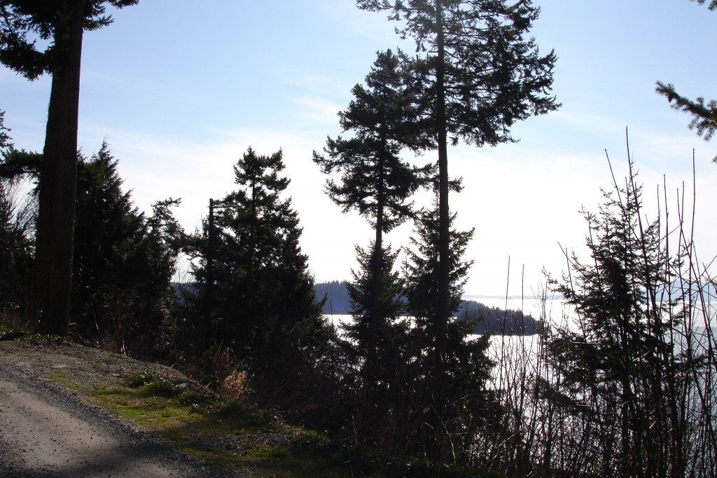
(See Interurban Trail Description for initial directions.) From the Lost Lake sign at 2.5 miles, continue straight and head south toward Larrabee State Park. At 2.8 miles cross California Street and from here on, the Interurban is a hard-packed rail trail. At 3.5 miles, just past Teddy Bear Cove (the trailhead is off Chuckanut Drive), cross Chuckanut Crest Drive, a private road. About one-third mile ahead, stunning views open up to the right revealing Chuckanut Bay, the San Juan Islands and on clear days, the Olympic Mountains.
At 5.2 miles, the trail crosses Cleator Road and almost immediately drops steeply into and climbs out of a ravine. (Cleator Road heads up—1,500-plus feet of up—for 3.6 miles to the Cyrus Gates Overlook parking lot.) At 6.0 miles, cross a paved private road adjacent to Dolphin Place off Chuckanut Drive. A half-mile ahead, the trail intersects the Fragrance Lake Trail. (Fragrance Lake Trail leads about 2 miles to gem-like Fragrance Lake.) And a little less than a half-mile beyond that, at 6.9 miles from the store, the Interurban Trail ends at the Clayton Beach Parking Lot.
From here, options include Fragrance Lake Road, which leads to Fragrance Lake as well as the south end of the Lost Lake Trail.
Hemlock Trail/Raptor Ridge (11.2 miles out-and-back)
(See Interurban Trail Description for initial directions.) From the Lost Lake sign at 2.5 miles, turn left and follow as the trail climbs quickly and (often) muddily. Soon enough the grade levels out and eventually switchbacks to the right up a wide shoulder and connects with an old logging road. Go left.
Just ahead, at 3.2 miles, go straight at a signed intersection. (You’re now on the Hemlock Trail.) After about a third of a mile, begin climbing fairly steadily. At 4.3 miles continue straight at an intersection with the Salal Trail, following the sign for Raptor Ridge. The trail soon narrows down to single track, starts climbing some more and becomes more rugged and technical. Just after entering an older section of forest, reach the intersection with the Raptor Ridge Trail at 5.3 miles.
One-third mile-long Raptor Ridge climbs through boulders and dense, almost cave-like forest to a rock outcropping offering an awesome 180-degree vista, 5.6 miles. Return the same way.